Today, we released a new version of ArcGIS Urban. A version that is again packed with exciting new features and lots of improvements. We are thrilled to present to you the highlights of this release:
- A new Quick Start experience and worldwide 3D data
- Numerical feedback when editing geometries
- Custom demolish areas in plans
- An even better metrics authoring experience
- Extendable zoning descriptions
Don’t want to miss a single detail about the features and improvements shipped in the new version of Urban? Read the release notes.
A new Quick Start experience & worldwide 3D data
Getting started quickly and easily is important when you are just starting with ArcGIS Urban or when you need to set up an Urban Model for a new location.
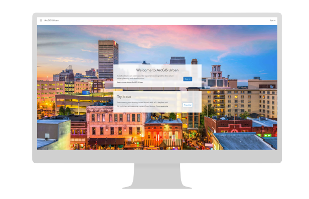
We’ve completely redesigned the landing page on urban.arcgis.com and added a new Quick Start experience with a step-by-step process and new out-of-the-box datasets for the entire world.
This means you can quickly choose the location of your new Urban Model on a map, select a template, and directly upload your parcels and zoning layers. Newly created Urban Models now come with default 3D base layers for existing buildings and trees based on Open Street Map data. You can also make use of the new 3D base layers in any existing Urban Model.
While many of these improvements are aimed at making it easier to get started, we also added updates that make it easier for you to search for Urban Models you already have access to (if you are signed in with your licensed ArcGIS Online account).
Do you want to learn more about the new Quick Start experience? Read this blog post.

Numerical feedback
When you are drawing a parcel in Urban, did you ever want a real-time measurement of its area? When you are editing building spaces, did you ever want live feedback on the length of the edges?
The October 2022 release of ArcGIS Urban introduces numerical feedback. New tooltips and labels display measurements whenever you create new or update existing geometries. We are convinced that this will make your editing experience in Urban a lot smoother and more data-informed.

Custom demolish areas
New development concepts usually need to be planned and designed with respect to the existing conditions such as buildings and trees. Imagine a parcel with two existing buildings that will be redeveloped. One of the two buildings is a historical building. In between the two buildings, there are some big old trees. The plan is to build an extension of the historic building and tear down the second building while conserving the old trees.
The new demolish tool, introduced with this release, adds more flexibility when demolishing. Besides removing all existing buildings and trees on a parcel you can now also draw custom demolish areas. This allows you to define more precisely where you want to keep existing buildings and trees and where you want to remove them to place new developments.

An even better metrics authoring experience
For this release, we worked hard to push the metrics authoring experience to the next level. A new metrics graph is at the very heart of our efforts.
The new metrics graph allows you to edit and persist the graph layout according to your needs. A new mini-map helps you to keep the overview of the entire graph as you explore it.
Metrics and metric connections are highlighted on hover. You can also add new metrics with drag-and-drop functionality and draw connections between metrics directly in the graph itself. This helps you to visually create calculations and understand how metrics depend on each other.
On top of that, we also improved the metric connections dialog. You can now choose from two additional contribution methods available and can configure space-use type metric parameters directly in that dialog.

Extendable zoning descriptions
Starting with this release, you can add extended descriptions to your zoning types, land-use types, and overlays. For instance, you can add bullet points with links to further legal documents to the description of a zoning type. Additionally, you can emphasize parts of your description text by making them italic or bold.
Your extended descriptions may include markdown syntax elements. Markdown is a widely used lightweight markup language to format text. Check out our docs to learn about the supported formatting options and where else in Urban you can use them.

BONUS: Get the list of web scenes created in Urban
Easily sharing and presenting information about future developments is important for the urban planning process. That’s why ArcGIS Urban allows you to create a web scene that shows a selection of plans and projects or the details of a plan scenario.
To ensure that you don’t lose track of the web scenes created in Urban, you can now access a list of all these web scene items. This supports you in managing and keeping an overview of the information bits you’ve created from your urban model.

Learn more
Do you want to learn more about the October 2022 release of Urban? For instance, how we improved the overview visualization or the city web scene creation?
Check out the release notes to read all the details about the features, improvements, and bug fixes released in the latest version of Urban.
Register for the webinar where you can see all these new features in action. Put a hold on November 9th in your calendar (9:00 a.m. – 10:00 a.m. (PT)).
Want to see these new features live in ArcGIS Urban? Please feel free to schedule a demo with our team.
Additional resources
Check out the ArcGIS Urban Resources StoryMap for a complete overview of all the available ArcGIS Urban resources.
About the author


Article Discussion: