It’s time for another update to ArcGIS StoryMaps!
This is the first release of 2020, but the fourth overall release of this new product. If you’re just catching up, you can review what was new in our July, August, and October releases, and here’s a rundown of new features added this week:
- Guided tour
- Map actions
- Format text with color
- Fit and fill options for video
- Narrative panel style options in slideshow
- Conclude your story with a credits section
- Publish a story privately or share it to a group
- …and much more!
If you’re still using Esri’s classic storytelling templates, you may get quite jealous after reading about all these new features. For advice on how and when to switch from classic to the shiny, new builder, check out this article: Moving to the new ArcGIS StoryMaps.
Guided tour
Story Map Tour has been an extremely popular classic storytelling template. In fact, the Esri storytelling community has created over 200,000 map tours! And now, you can use the new ArcGIS StoryMaps to create beautiful, engaging place-based guided tours (beta).
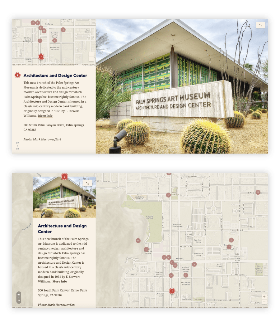
There are two tour layouts to choose from: media-focused and map-focused. These options, as their respective names imply, devote different amounts of screen real estate to the media and map content of the tour. Pick the one that suits your needs best, but don’t worry, you can easily swap between layouts anytime if you change your mind later. Both layouts are shown below; media-focused on top and map-focused on the bottom.

Using a similar building experience as other immersive blocks like sidecar and slideshow, you can easily create a guided tour to walk readers through a set of interesting places. Each place can have multiple images, and all information is optional. If you don’t want a place to have a name or a description, just leave it blank.
For more information on guided tours read our blog on how to build one and check out these stories that contain guided tours. The first two use the media-focused layout and the third uses map-focused.
Map actions
Another popular feature of Esri’s classic story map templates has been story actions. This powerful storytelling tool lets you create a link in your narrative that makes your story interactive without putting any pressure on your readers. For example, an action link can move a map to a new location and toggle map layers on or off to create a completely new map view that supports a point you’re making.
We’ve reimagined story actions for the new ArcGIS StoryMaps and now call them map actions (beta). They still give you powerful capabilities, but we think you’ll find them a snap to configure and your readers will find them even easier to use.
The most important thing to know about actions is they can be added from the block palette in any sidecar slide that already has a map or scene added to its media panel. For all the details on how and when to use map actions, check out this article.
Format text with color
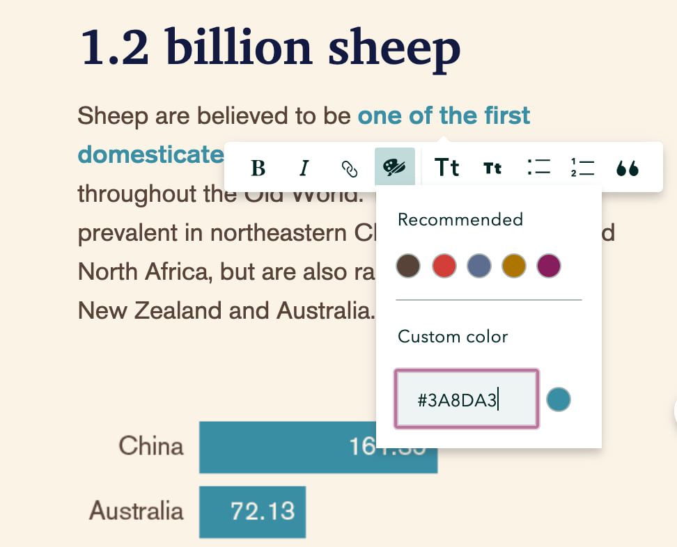
Formatting text in your story using color is a common feature request that we’ve been working on for a while. We know authors love to express themselves using color and there are many popular storytelling techniques for matching story text color with map symbol color to create your own DIY legend that’s often more effective than a traditional map legend. So, we’re happy to be able to release the ability to format text with color.

You can specify any color you’d like by entering a hex code under custom color, or you can use the color chips to use theme colors in your story. If you update the theme, any text formatted using theme colors will also update to the new theme’s recommended theme colors. If you’ve specified a custom accent color in the design panel, that color will also be available for you to use to format text. If you update that color in the design panel, any text formatted with that color will also update.
Fit and fill options for video
When using a video in an immersive media panel, you now have the option to choose whether the video fills the frame or fits inside it. If you choose to fill the frame, you can select a focal point so the important part of the video is always shown, no matter what size device a reader may be using. When fitting the video, you’ll have the option of choosing the background color for the media panel.
Narrative panel style options in slideshow
When creating a slideshow, there are now two additional options for styling the narrative panel. These options both make the panel background transparent and provide a choice between light or dark text. These styles are useful for blending the text more naturally with the background media.
Conclude with credits
You can now add a credits section at the end of your story to acknowledge your collaborators and cite your sources. The credits section is already on for any new stories you create, but it won’t appear in your story unless you add information to it. If you don’t need it, simply toggle it off in the design panel. If you do want to give credit where it’s due, just fill out the section however you like and be sure to include links anywhere you need to point to source material.
New publishing and sharing options
There are two additional publishing workflows supported by the story builder. You can now choose to publish a story privately, which allows you to make unpublished changes to a story without having to share it with anyone else. This can be useful for stories you create to use only as a presentation, for example.
Additionally, you can share a story with groups you belong to. When publishing and sharing a story to a group, the story content’s sharing permissions are checked, as usual, and its maps, scenes, and layers will also be shared to the group, if necessary. Sharing to a group works in conjunction with the other sharing options. First, you choose whether to keep your story private or share it with your organization or everyone, then you can pick group(s) to share it to.
When browsing your content in ArcGIS StoryMaps, you’ll noticed the Shared with me tab has replaced My Organization. This is where you’ll see all items shared with you through either your organization or groups. Use a keyword search to quickly locate specific items that have been shared with you through either of these collaboration pathways.
And more…
In addition to all the new features described above, there are oodles more enhancements in this update. Please let us know what you think about any or all of these new goodies by dropping us a note on the ArcGIS StoryMaps GeoNet community.
- Print a story (beta — note: printing guided tours is not yet supported)
- A full-page preview mode is available in addition to the device previews
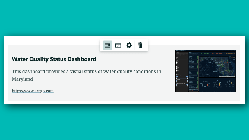
- Edit details for embeds shown as cards and upload an alternative image for in-line embeds (learn more)
- Snap points and leader lines to other feature vertices when editing express maps
- Format headings using italics
- Hide social sharing icons for published stories
- Many fixes and stabilization improvements
Banner photo by Zoran Borojevic on Unsplash


Commenting is not enabled for this article.